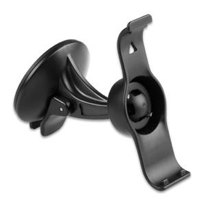
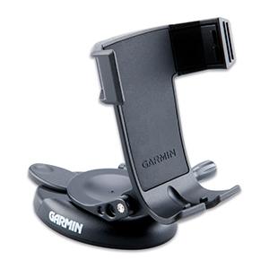
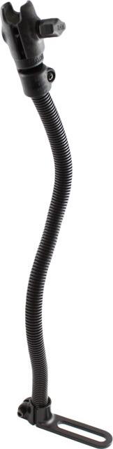
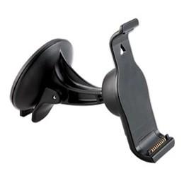
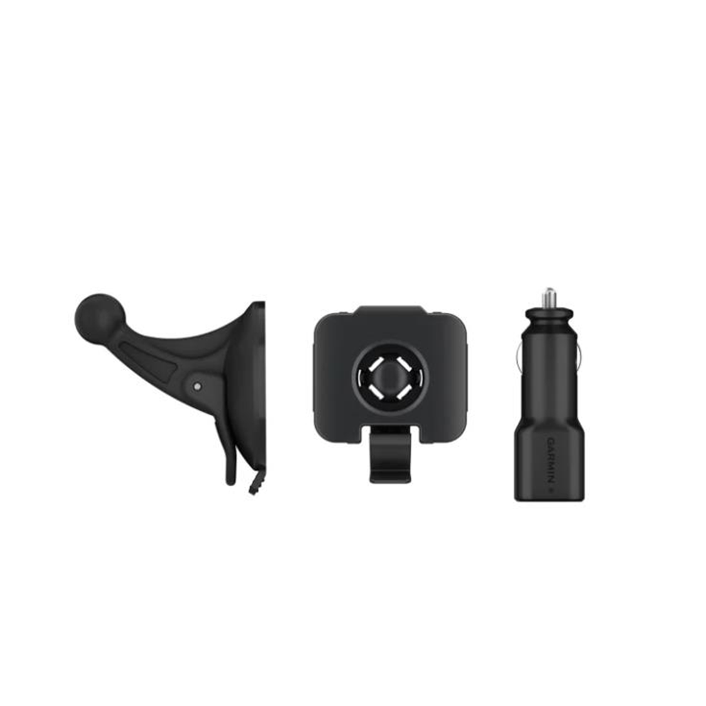
Mit dieser verstellbaren Halterung können Sie während der Fahrt im Fahrzeug gut auf Ihr kompatibles Garmin Drive Luxe zugreifen. Befestigen Sie die Halterung einfach mit dem Saugnapf an der Windschutzscheibe oder einer anderen glatten, flachen Oberfläche, um Ihr Gerät im Blick zu behalten. Type Navigation Mount Field of Application Motor Vehicle Information Befestigung durch Saugfuß Colour Black
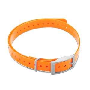
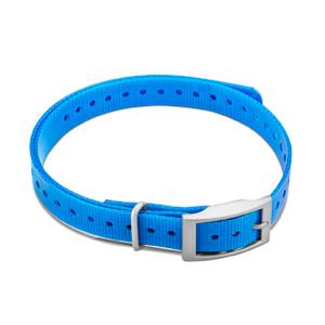
Our polyurethane-coated collar straps are rugged and water resistant, just like the original collar that came with your dog training devices. The 3/4-inch nylon collar is 27 inches long, has a nickel-plated square or roller buckle, collar keeper and has holes spaced to fit most dogs. Its available in multiple colors with either a square or roller buckle (sold separately). Sobib järgmistele Garmini toodetele: Garmin BarkLimiter / 2 / 2VT / Deluxe Garmin Delta / Inbounds System / Smart Dog Training System / Sport / Sport XC / Upland XC / XC Garmin PRO 550 / 550 Plus / 70 Garmin PT 10 Dog Device Garmin Sport PRO Garmin T 5 Mini Dog Device Garmin TT 15 Mini Dog Collar Garmin Upland Beeper
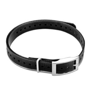
Our polyurethane-coated collar straps are rugged and water resistant, just like the original collar that came with your dog training devices. The 3/4-inch nylon collar is 27 inches long, has a nickel-plated square or roller buckle, collar keeper and has holes spaced to fit most dogs. Its available in multiple colors with either a square or roller buckle (sold separately). Sobib järgmistele Garmini toodetele: Garmin BarkLimiter / 2 / 2VT / Deluxe Garmin Delta / Inbounds System / Smart Dog Training System / Sport / Sport XC / Upland XC / XC Garmin PRO 550 / 550 Plus / 70 Garmin PT 10 Dog Device Garmin Sport PRO Garmin T 5 Mini Dog Device Garmin TT 15 Mini Dog Collar Garmin Upland Beeper
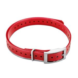
Our polyurethane-coated collar straps are rugged and water resistant, just like the original collar that came with your dog training devices. The 3/4-inch nylon collar is 27 inches long, has a nickel-plated square or roller buckle, collar keeper and has holes spaced to fit most dogs. Its available in multiple colors with either a square or roller buckle (sold separately). Sobib järgmistele Garmini toodetele: Garmin BarkLimiter / 2 / 2VT / Deluxe Garmin Delta / Inbounds System / Smart Dog Training System / Sport / Sport XC / Upland XC / XC Garmin PRO 550 / 550 Plus / 70 Garmin PT 10 Dog Device Garmin Sport PRO Garmin T 5 Mini Dog Device Garmin TT 15 Mini Dog Collar Garmin Upland Beeper
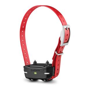
Train Multiple Dogs with your PRO 70/550 or Sport PRO Systems Train up to 6 dogs on 1 PRO 70 handheld, up to 3 dogs on 1 PRO 550 handheld or up to 3 dogs on 1 Sport PRO™ handheld (additional dog devices required; purchase separately) 1 mile range Built-in BarkLimiter™ Remote operation of beacon lights on dog device Interchangeable contact points The PT 10 dog device works with the PRO 70, PRO 550 and the Sport PRO handhelds, allowing you to add more dog device collars to your pack. Train up to 6 dogs on 1 PRO 70 handheld, 3 dogs on 1 PRO 550 handheld or 3 dogs on 1 Sport PRO handheld (additional dog devices required) with a range of 1 mile, plus remote-operated LED beacon lights for low light conditions and built in BarkLimiter, activated on the dog device, for a quieter kennel.
The ballistic nylon antenna keeper protects the flex band on the your compatible dog tracking collar from damage that may occur during use. Sobib järgmistele Garmini toodetele: Garmin 100 / 300 / 300i / T 20/ TT 25 Garmin astro 320 Garmin Dog Device T 5X Garmin PRO 550 Plus Garmin T 5 Dog Device Garmin TT 15 Dog Device
Standardset akukomplekti laadimiseks kinnita oma ühilduv koeraseade lihtsalt selle laadimisklambri külge, kui seda parajasti ei kasutata. Akukomplekti laadimiseks selle arvuti või toiteadapteriga ühendamiseks kasuta USB-C-kaablit (müüakse eraldi). Kasuta ainult standardse akukomplektiga. Sobib järgmistele Garmini toodetele: Garmin Alpha T 20 / TT 25
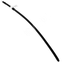
See kompaktne ja kasutaja vahetatav 37 cm VHF-antenn sobib suurepäraselt väiksemat tõugu koerale või kui eelistad koera ühilduvale kaelarihmale lühemat antenni. See lühem VHF-antenn võimaldab ühilduva käsiseadmega (eraldi müügil) vaid 3,2 km raadiuses jälgimist. See sisaldab kolme antenniklambrit, et antenn püsiks kindlalt koera kaelarihma küljes. Sobib järgmistele Garmini toodetele: Garmin Alpha T 20 / TT 25
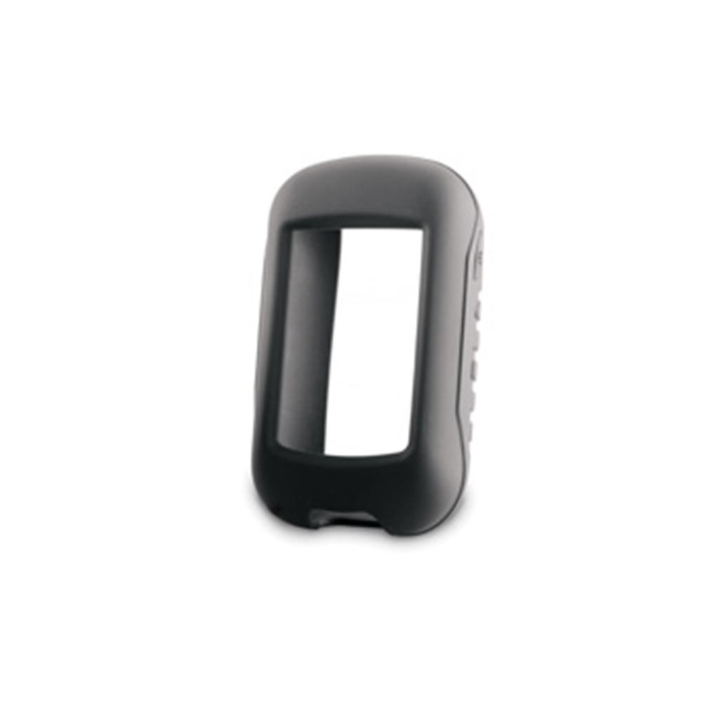
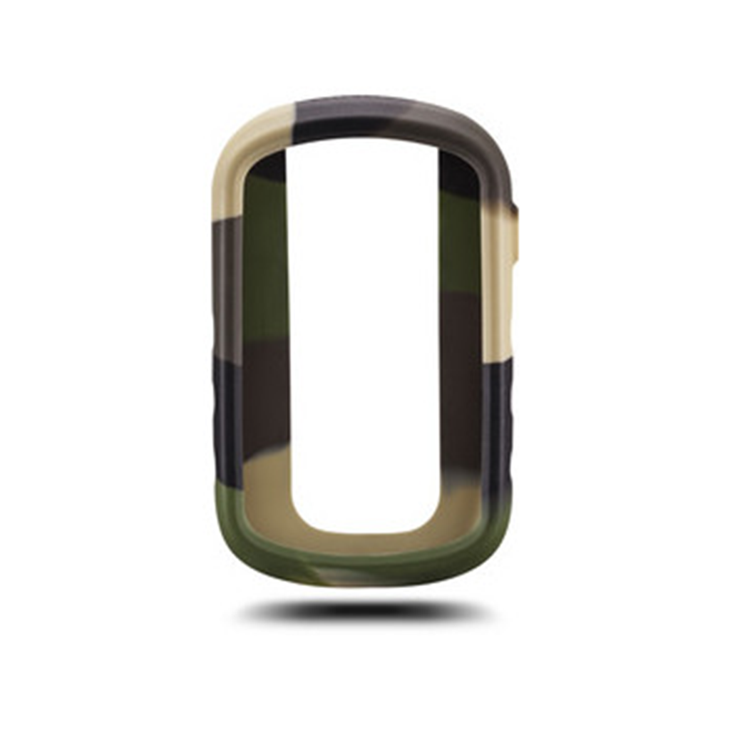
Protect your eTrex Touch with these form-fitting, removable silicone cases. Available in an assortment of colors (sold separately). Sobib järgmistele Garmin toodetele: Garmin eTrex Touch 25 / Touch 35
Protect your eTrex Touch with these form-fitting, removable silicone cases. Available in an assortment of colors (sold separately). Sobib järgmistele Garmin toodetele: Garmin eTrex Touch 25 / Touch 35
Protect your eTrex Touch with these form-fitting, removable silicone cases. Available in an assortment of colors (sold separately). Sobib järgmistele Garmin toodetele: Garmin eTrex Touch 25 / Touch 35
Protect your eTrex Touch with these form-fitting, removable silicone cases. Available in an assortment of colors (sold separately). Sobib järgmistele Garmin toodetele: Garmin eTrex Touch 25 / Touch 35
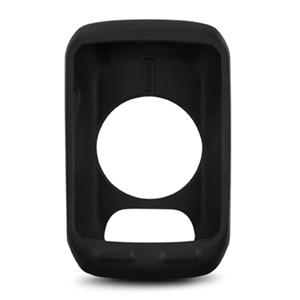
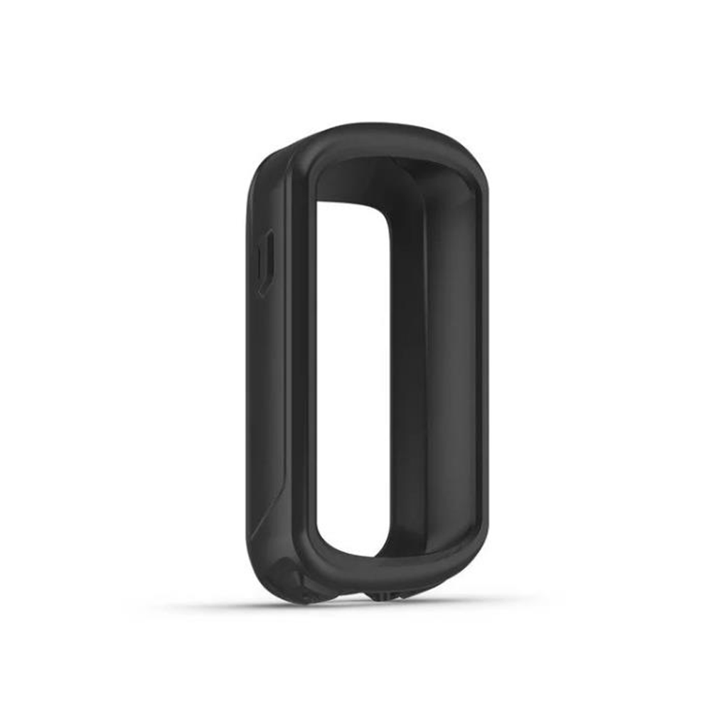
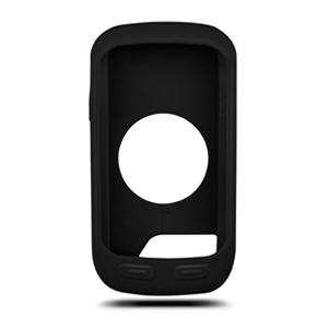
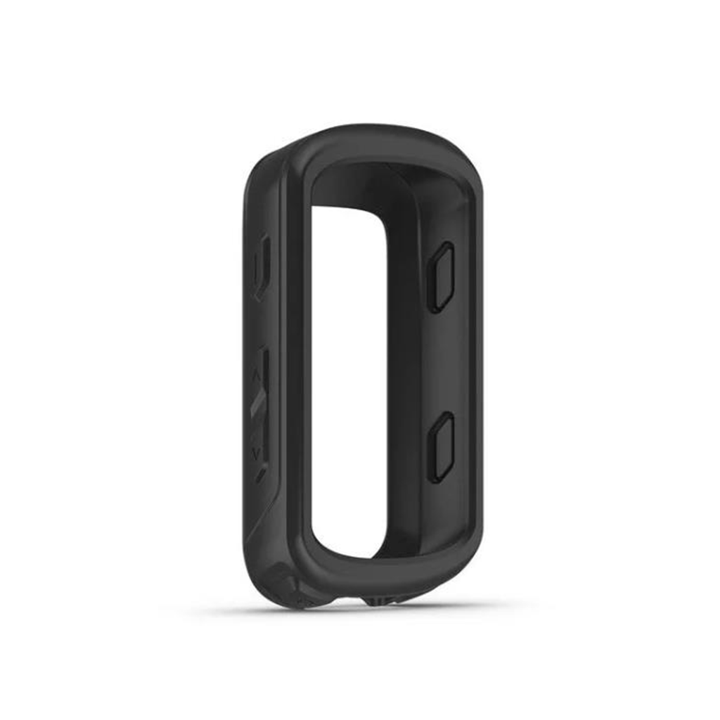
Protect your Edge® 530 with this form-fitting, removable silicone case. Available in other colors (sold separately). Sobib järgmistele Garmini toodetele: Garmin Edge 530 / 530 Mägijalgratta komplekt
Protect your Edge® 830 with this form-fitting, removable silicone case. Available in other colors (sold separately). Sobib järgmistele Garmini toodetele: Garmin Edge 830 / 830 Mägijalgratta komplekt
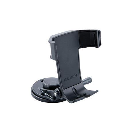
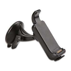
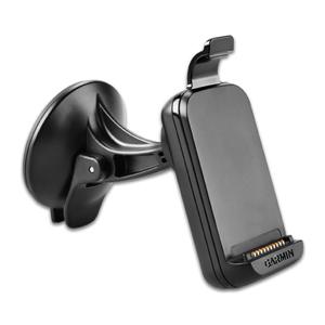
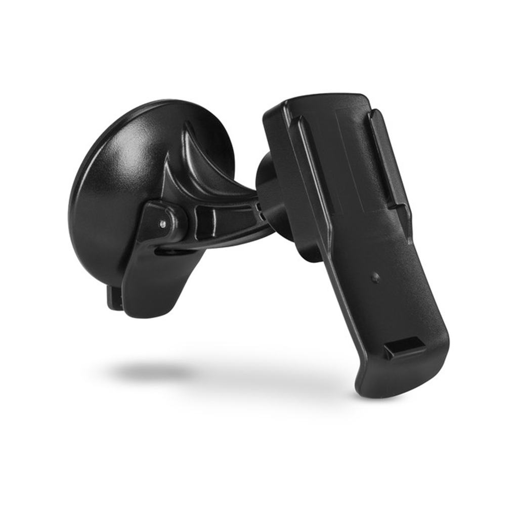
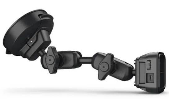
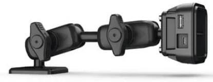
Secure your compatible device to your windshield or any smooth, flat surface with this suction cup mount. An additional Spine Mount Adapter is required when used with the inReach® Mini 2 device.
Paigalda see kasutaja vahetatav painduv rihm ühilduvale koera kaelarihmale. See lühem painduv rihm sobib suurepäraselt väiksemat tõugu koerale või kui eelistad diskreetsust. See sisaldab kolme antenniklambrit, et antenn püsiks kindlalt koera kaelarihma küljes. Sobib järgmistele Garmini toodetele: Garmin Alpha T 20 /TT 25
Protect your compatible outoor device from the sun and scratches when not in use. This protective cover fits snugly over the display to avoid exposure. Sobib järgmistele Garmin toodetele: Garmin GPSMAP 276Cx
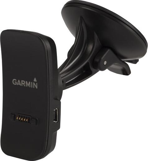
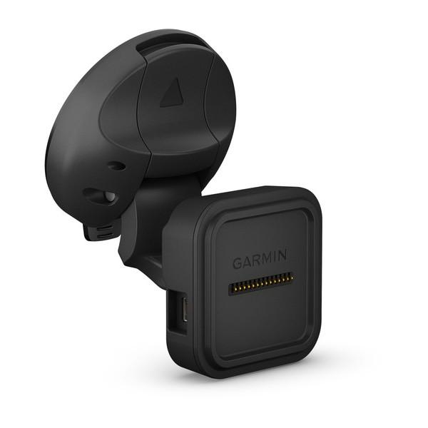
Paigaldage oma ühilduv seade selle iminapa kinnitusega navigeerimise ajal. Toiteallikaga magnetkinnitus laeb teie seadet sõidu ajal. Lihtsalt imege oma alus tuuleklaasile või mis tahes siledale tasasele pinnale. Sisaldab iminapa kinnitust ja magnetkinnitust.Ühildub:Camper 785 & Digital Trafficdēzl™ 780 LMT-SdēzlCam™ 785 LMT-S
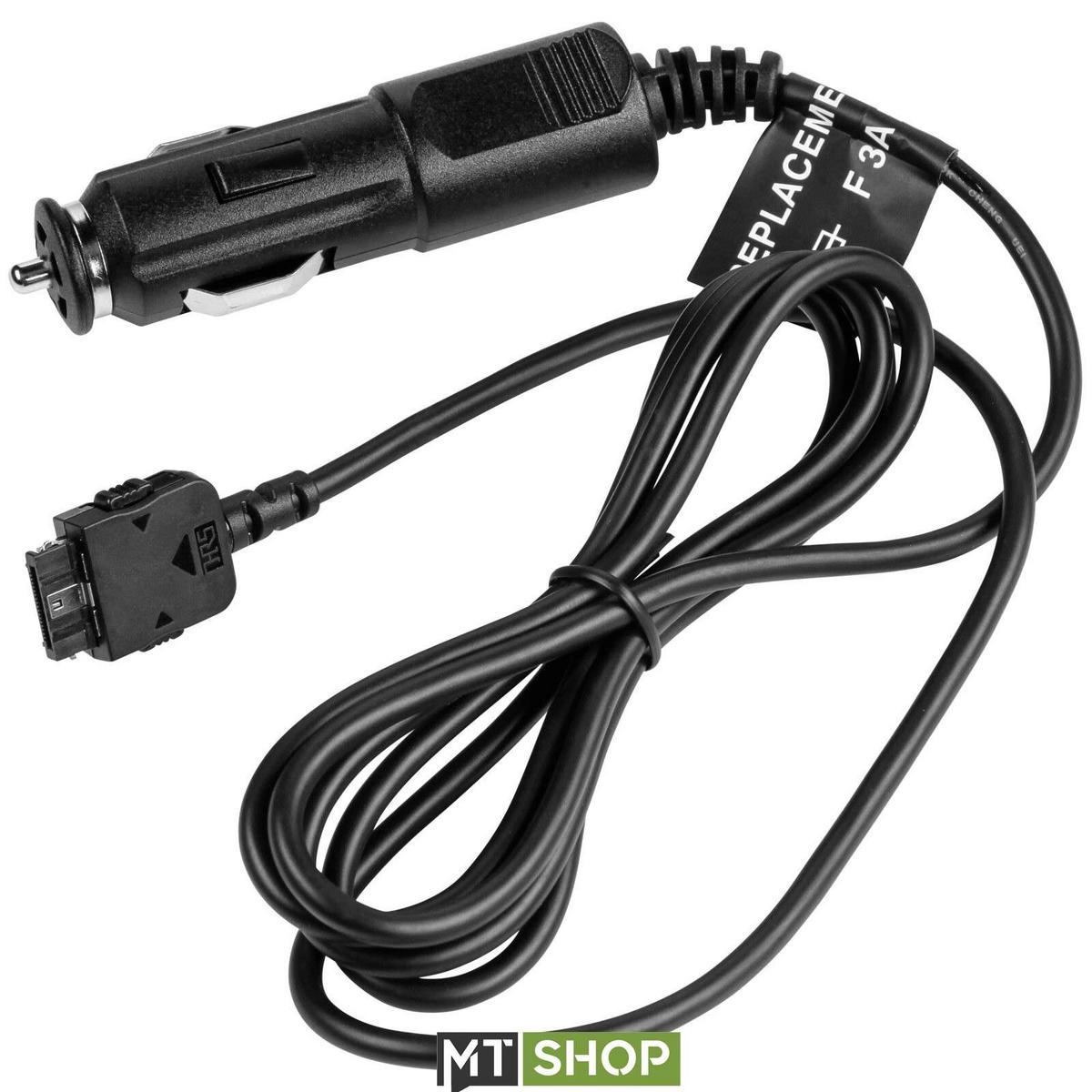
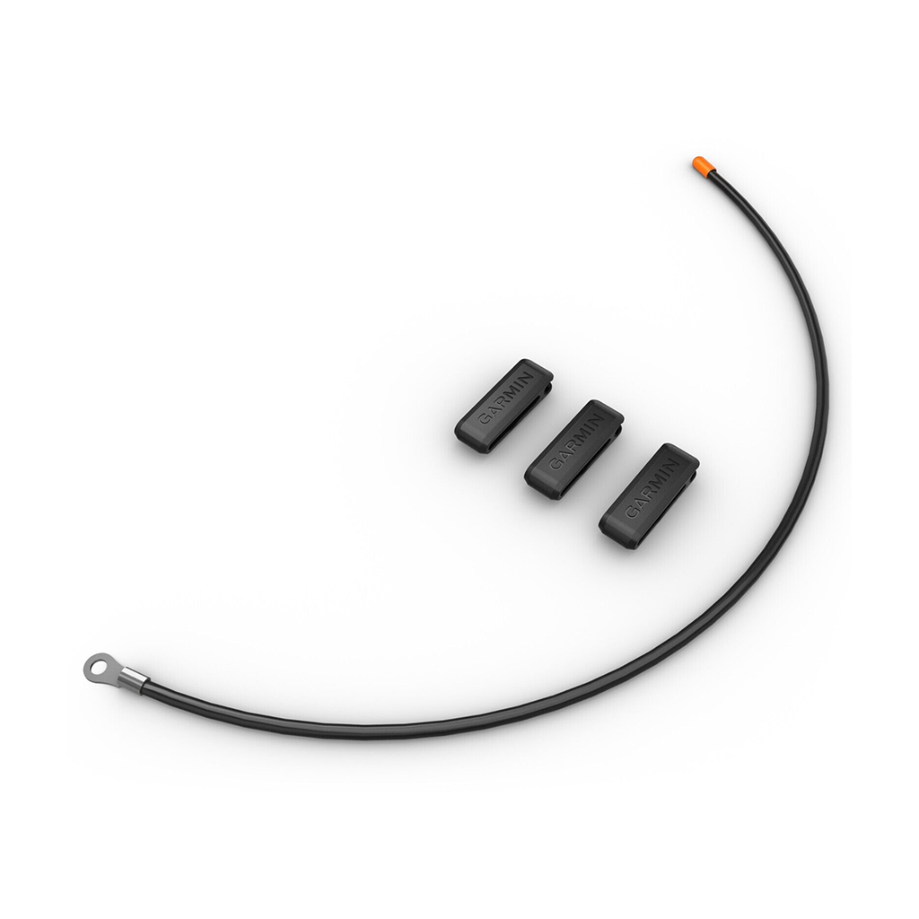
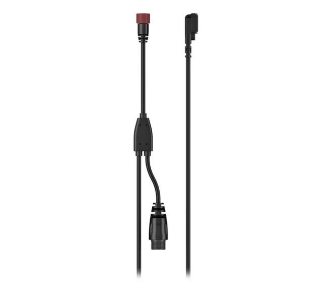
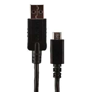
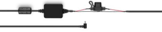
Ühendage oma ühilduv Garmini seade selle tühja kaabliga. Kaabel toidab teie seadet ja ühildub nii 12 V kui ka 24 V süsteemidega.Ühildub:Garmin Catalyst™ Driving Performance OptimizerOverlander®